Last year, two projects were approved by the Development Agency of the Banská Bystrica Self-Governing Region with the aim of developing the Muránska Planina National Park as a competitive natural destination and a place for quality local life. The funding comes from the mechanism of the Recovery and Resilience Plan - Call for Applicants for Development Projects for the Transformation of the Muránska Planina National Park Region. One of the projects focuses on the sustainable development of cycling in the area. Its implementation is progressing.

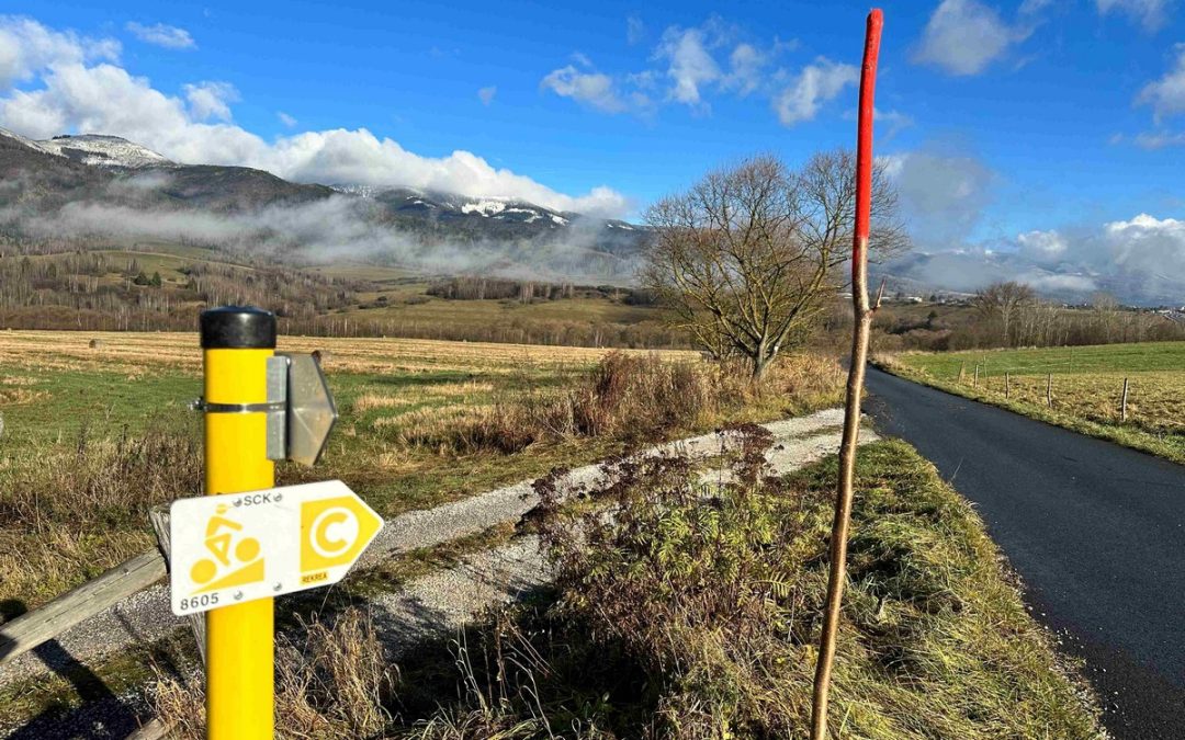
Specific activities will be directed towards the development of cycling routes in the national park in order to preserve biodiversity. The project also includes the creation of a data base for visitor management and comprehensive coordination of cycling development in accordance with the principles of sustainable tourism development. One of the objectives is "Creation of a data base for the management of the management, maintenance and monitoring of the cycling infrastructure and visitor management of the Muránska Planina National Park." The aim of the data analysis is to have all information about cycling routes in digital form, with the possibility of easy and clear viewing and filtering. This will allow for easier identification of trouble spots and subsequent ability to react more quickly in case of detected damage, such as a fallen tree on the route, missing or damaged signage, etc. The digital record keeping system will also facilitate the process of planning the restoration and maintenance of signage in the field.
It is in this area that the first steps towards achieving the objective are visible. "We have created a data model, which forms the basis of a unified database of spatial data that will help us to manage the territory of the Muránska Planina National Park in terms of cycling tourism, the intensity of the load of cyclists on the environment and, last but not least, for strategic planning of other activities" says Peter Krušinský, the project coordinator.
Two mobile apps have been created. The first one is used for the actual data collection in the field, where data such as the route itself, its surface types and all the point elements of the cycling infrastructure (cycle markers, painted markings, rest areas, infopoints, etc.) are recorded at the same time. Any deficiencies, defective or damaged markings, obstacles, or suggestions for the addition of markings, surface modifications or infrastructure elements are also recorded.


The second mobile application is still used in the field as a navigational basis, for the navigation of field workers, the correct identification of routes and features on them. These data were collected and registered in the passport of cycling routes implemented by the Development Agency of the Banská Bystrica Self-Governing Region (RABBSK) in 2019-2020. Due to a completely new data model with different parameters, as well as taking into account the time lag, these original documents need to be re-verified in the field, so they are used as a starting source and navigation.
Once all the new data has been populated, this second mobile app will serve as a field inspection app that will be used by the dispatched field worker to solve all on-the-spot field tasks.
In the words of Petr Švehla, GIS analyst at RABBSK , "the mobile application is complemented by a basic desktop web application, where the initially collected field data is displayed and subsequently will be supplemented with all the attributes of the new data model. The advantage of such processing is that all infrastructure elements can be immediately seen in space, filtered based on defined attributes, etc. At the same time, a real-time view of the status of routes and infrastructure in terms of failures and similar phenomena is available, which makes it directly possible to start planning future repairs, for example."

Peter Krušinský states that after processing all the collected data, further phases of the project will be implemented, such as legalization and gradual marking of new cycle routes, maintenance of current routes and infrastructure, etc. Subsequently, further web applications and dashboards for management, analysis and strategic planning will be added. As he added: " in this first phase, we have walked, mapped and surveyed more than 510 kilometres of cycling routes in the territory of the Muránska Planina National Park and its surroundings. We mapped 184 signposts, 387 infrastructure elements, 1216 elements of additional painted markings and noted 76 deficiencies".

